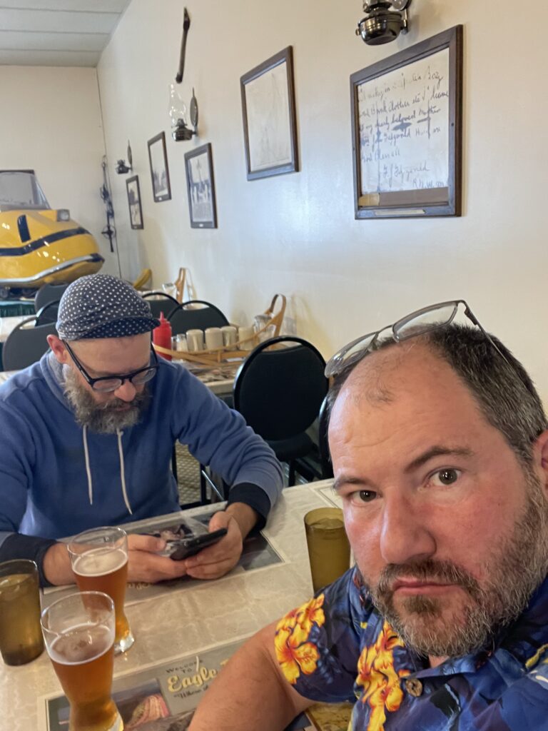
Riding a motorcycle to Tuktoyaktuk is not as deadly as attempting to summit Mount Everest. It is, however, not without peril. Only so many riders attempt the Tuk run every year, and every year a few die trying, and more get hurt and/or wreck their motorcycles.
We did not die.
WHERE IS TUK?
Tuktoyaktuk (“Tuk” to its friends) is in the Northwest Territories of Canada, once an isolated village on the Arctic Ocean, with overland access only by a seasonal ice road. In 2017 the all-season road was extended from Inuvik to Tuk, and with it opened the prospects of much more casual tourism. It is famous as the northernmost road you can drive to in Canada, and possibly (I was too lazy to check) the only public road to the Arctic Ocean on this continent.
The road is an extension of the infamous Dempster Highway, which leads from (more or less) Dawson City to Inuvik. both parts are unpaved, though some parts are more unpaved than others. It is, however, “good gravel.” The road is quite wide and aggressively maintained, and if you’re used to Forest Service Roads in BC, or other similarly semi-maintained unpaved roads, this may be the nicest one you’ll ever see. Heavy trucks routinely traverse it with a minimum of trouble, indeed they are the reason the roads exist. On the day we left Inuvik, we saw a Chrysler 300 sedan coming towards us from Tuk. Four wheels have little trouble with the typical state of the road, as long as they take a bit of care for the deeper potholes.
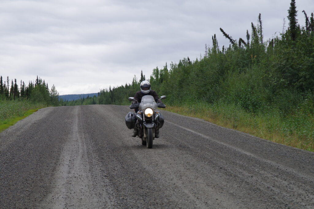
Motorcycles are a different story. The road is wide but the gravel is loose. While all kinds of motorcycles have successfully made the trip, a smart rider will bring something with suitably chunky tires and a chassis to match. Ground clearance is not that important, but a stable front end is. Adventure or dual-sport motorcycles are the default choice for riders (to the point where the Yamaha Tenere 700 seems to be the Official Motorcycle of Riding The Dempster) but just about every street bike you can name has made it, at least when conditions are good. But the danger is real: one rider posted about how he took a sip of water wrong from his hydration pack, had a coughing fit, and the subsequent crash knocked him unconscious, put him in the hospital for a few days, and destroyed his motorcycle.
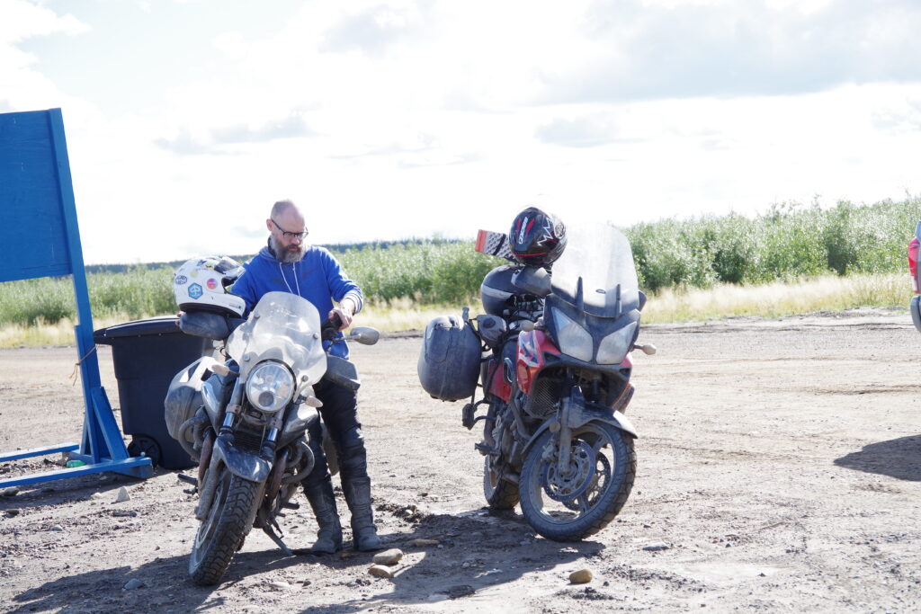
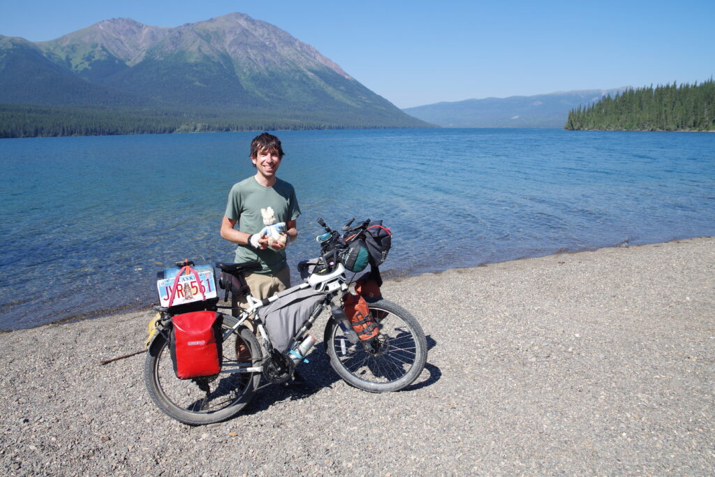
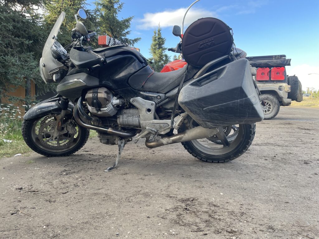
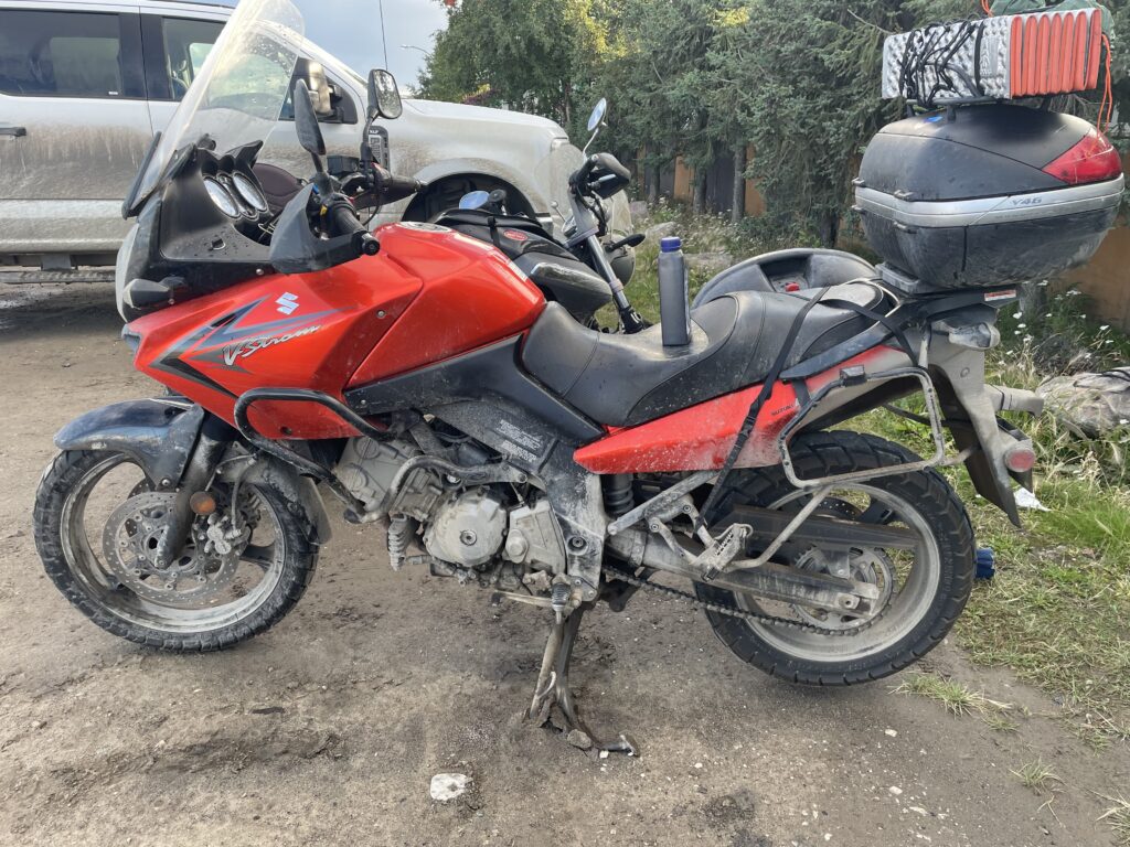
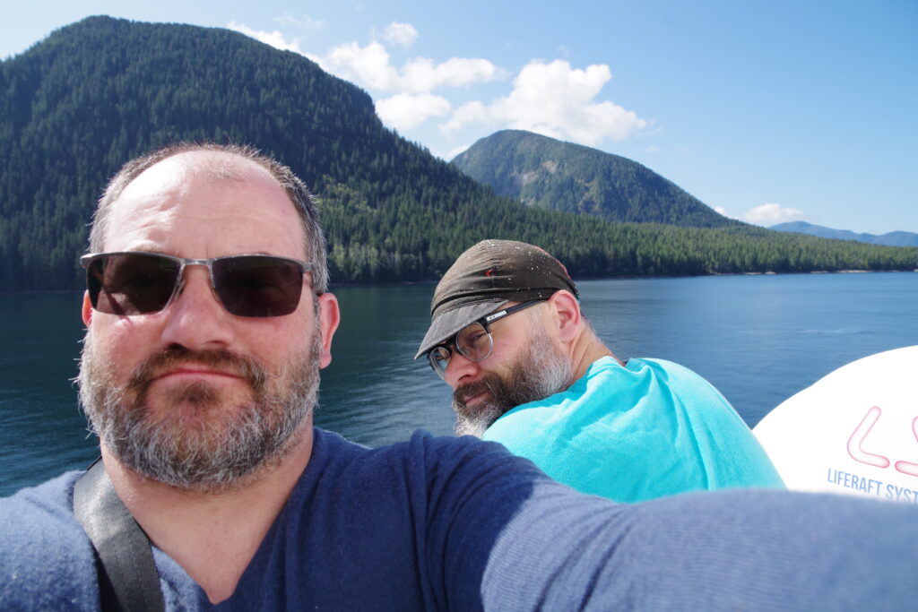
Tobin came to me with the idea of this trip in the Summer of 2023. I did not have a remotely suitable motorcycle and expressed same. So we bought one: a well-used but well-prepared 2009 Suzuki VStrom 650, the Official Motorcycle of Riding The Dempster but not buying a new Tenere 700. Tobin had something I didn’t have (considerable off-road skills) so he just mounted a set of chunky all-terrain tires (Tractionator GPSes for you tire aficionados; my VStrom came with fresh Shinko 705s) and generally refreshed his 2007 Moto Guzzi Breva to get it ready. The Breva is resolutely a street bike, so getting it to the finish line and back would demonstrate the point that the Dempster Highway is not that challenging as a road.
We also brought another asset on this trip: time. With three weeks to complete a trip that might take as little as two weeks if we hurried, we could wait out bad weather if needed.
And so on August 7, we set off for Tuk with two fully loaded motorcycles.
The first chunk of the trip was just another road ride: we rendezvoused at a gas station nice and early, and rode to Hope for breakfast. We had hoped to head up via Sea to Sky, Whistler, and the Duffy Lake Road, but a recent mudslide made that route uncertain, so we took our alternate route via the Fraser Canyon.
Rolly’s in Hope is now something of a tradition for these road trips: it’s delicious, cheerful, and opens pretty early for breakfast. The omelets are excellent.
Up route 1 (Fraser Canyon), over to 97, past various adorable towns and on to Ten Mile Lake Provincial Park, where we set camp for the night. This was a long day by design, and lovely roads, but we had ridden virtually all of this before, and had even stayed at Ten Mile Lake before. The fact we returned is an endorsement. Go stay at Ten Mile Lake, it’s a nice provincial campground for nice people.
AN ASIDE ABOUT CAMPING GEAR
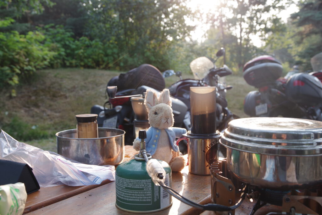
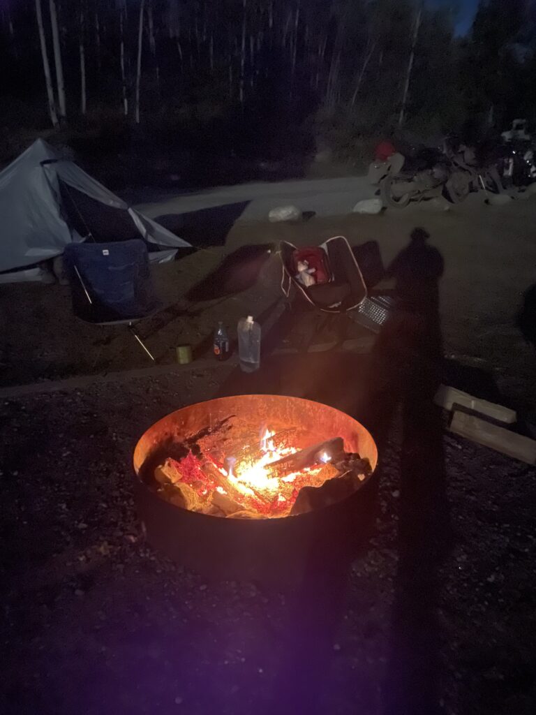
Yes, we mostly camped. And so no trip report would be complete without a gear report, because the only thing campers like more than camping is talking about, acquiring, or pondering equipment. Fine, maybe I’m projecting.
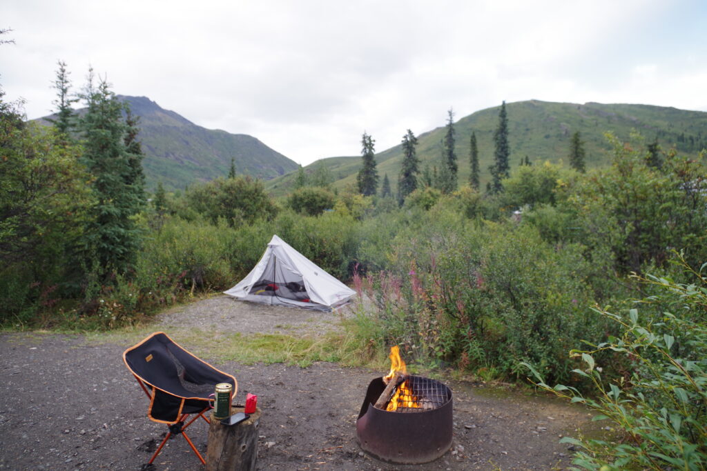
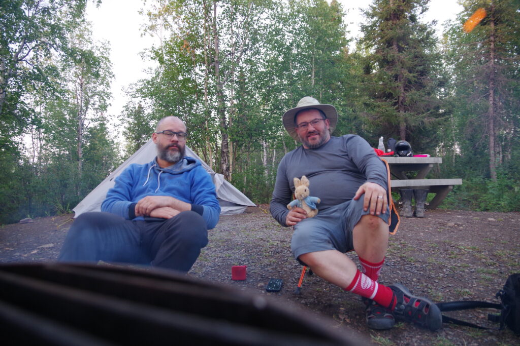
Tobin carried a Six Moons tent which is a perfectly normal good tent. It ostensibly sleeps two (yeah right) but comfortably sleeps one, is light, and leaves enough room inside to keep some gear dry when it rains. This is supplemented with the right pad—Thermarest inflatable or something similar—and new for him this year, a camping quilt instead of a sleeping bag, reflecting current thoughts about efficient use of fill (in short, the fill that you crush down with your body does almost nothing, so don’t use it, just have fill on top and a better sleeping pad). This kit caused almost no trouble during the trip, and he consistently set up and tore down faster than me.
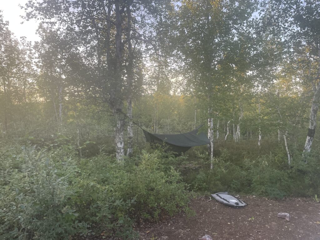
I, being a weirdo, use a hammock tent, in particular, a Hennessy Hammock Expedition Classic. Without getting too deep in the weeds, the setup is slightly fussy (practice helps a lot), but I sleep like a baby. I literally prefer sleeping in the hammock to a conventional bed.
My innovation this year was to fix the one weakness of any hammock: thermal management. You dump heat out of your exposed bottom side. But the new hotness (literally) is a down hammock quilt, which hangs from and hugs the hammock’s outside where it doesn’t get crushed by your bodyweight. This item alone has reversed my hammock from “comfy but thermally challenging” to “WARM AND COSY!!!” and now I never want to sleep anywhere else.
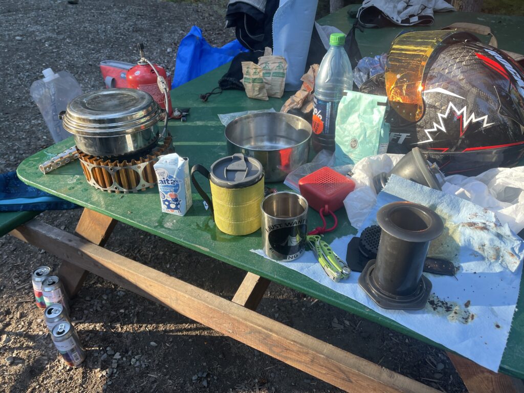
The rest of our gear is mostly basic and predictable: isobutane stoves, a Platypus 2 L water “bottle” (it stands up on its own but collapses into a flat plastic bladder when not full of water; it was instrumental on our frequently water-challenged journey), an Aeropress and Hario Skerton grinder for morning coffee, these clever tinned candles that act as a decent substitute for a camp fire when there’s a ban on, and . . . sorry I nodded off during my own gear-porn aside, let’s get back to the story.
BACK TO THE STORY
We slept comfortably at Ten Mile Lake, ate somewhere, I guess, and sped on for another long day, target: Meziadin Lake Provincial Park. It was hot, and we stopped in Smithers to visit my old friend Ben, where we drank his soda water greedily and got beat by him at pinball. Smithers looks like a lovely place to live in the summer, and I am assured he and his whole family are really, really into cross-country skiing, so I guess the winter works out too. After a short visit, we had to get back on the road to get back on schedule.
Some time on the first day I said how once we got to the Territories we would have to pay attention to logistical questions like where to eat, where to get food, where to get gas, and where to get booze. I don’t want to make us out as alcoholics, but we enjoy a beer in camp after the tents are set up and the fire (or fire-ban-approved candle) is lit.
Anyway the first day we had logistical problems was the second day. We came to Kitwanga, which on a map looks like a gas station, a few restaurants, and a small settlement, and so we expected to find a reasonable array of services. What we found was a restaurant that closed at 5 pm, a convenience store with a limited selection of food, and that was pretty much it. There was a rumor of a Chinese take-out somewhere in town, but it seemed dubious. And there was no liquor store, oh no.
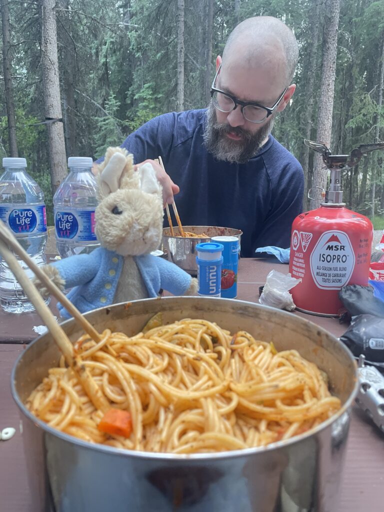
We improvised a meal of spaghetti with clams and sauce, thanks to the existence of a surprisingly large clam-meat can on the shelves, and cooked it in camp at Meziadin Lake, with NO after-dinner beer. It was a sobering reminder of how fast things were changing, with regard to services on the road.
The riding so far was mundanely spectacular. We were on Highway 16 most of the day, famous as one of the best motorcycle-riding roads in the province, and also, um, as the “Highway of Tears,” land of far too many tragic murders and disappearances, mostly of young indigenous women.
Rising in Meziadin Lake, we set off for a relatively easy 486 km jaunt up BC 37, aka the Cassiar highway. This is a land well into the realm of no cel service and minimal fuel stops, so a few places are worth noting:
Bell 2 appears as near nothing on maps, but is a full-service lodge with fuel, a nice cafe with excellent avocado toast, and reasonably priced offsales. Also if you’re lucky, you’ll get to see a helicopter take off from the adjacent pad, as the parking lot is barely outside of the downwash zone. We enjoyed stopping there so much on the way up that we made sure to return.
Dease Lake appears as a town on maps, but is a gritty gas station convenience store with marginal food options and attached liquor store. You won’t die, but it’s not a place to stop for a meal. It seems almost cruel to mention, but on our return trip we saw two clerks struggle with loading a label printer for about ten minutes before a third clerk was able to help them through it. We saw this because we were waiting to be served while this was going on.
Pro tip: the settlement has no cel service, but the Service BC offices, about 200 m from the gas station, do have free wifi available, whether the office is open or not.
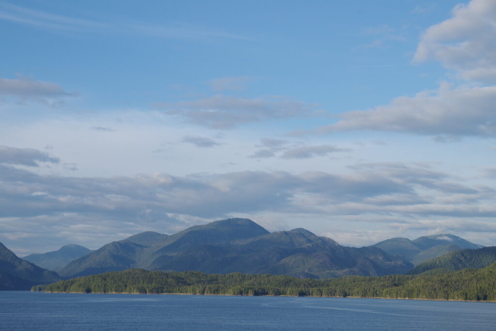
And then on to Boya Lake, our resting place for the night. I’ll simply say we didn’t enjoy Boya Lake as much as we should have on this stop, but we returned to it on the way home, and it made such an impression that I would happily plan a trip just to go back to this magic place. It has a very swimmable lake that is as deep blue as Jasper, but not nearly as overrun. If it was 500 km closer to any kind of city, it probably would be super-famous and overrun, so let’s keep it our little secret, okay?
This is also where, thanks to a regionally-waived fire ban (don’t ask don’t tell) we ordered two tubs of wood from the ranger, at $10 each. “Are you sure? That’s a lot of wood…” The ranger was correct and we didn’t nearly use all of the wood and we regret nothing.
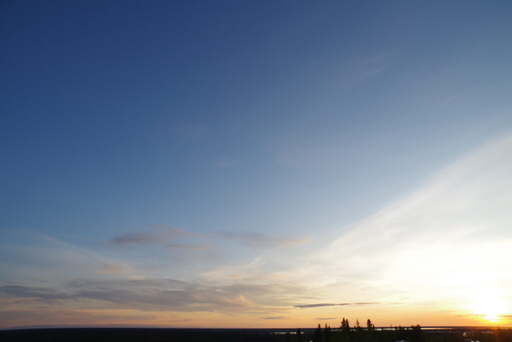
This is also where we really saw the days get longer. At a time of the year when the days were growing shorter, sunset was about 30 minutes later here than it was at our last campsite. We knew the days would grow longer as we went north, but 30 minutes in a day! We did not expect that.
YUKON HO!
The morning was another fine riding day, and we rode off on the last bit of the Cassiar before arriving in the Yukon Territory, and the junction of the BC 37 and the Alaska Highway, aka Yukon Route 1. The junction is another gas stop, and while the food trailer there is humble in its offerings (and was closed when we got there on this morning), the ageless Missouri-born woman running it was so charming I would stop there just to say hi.
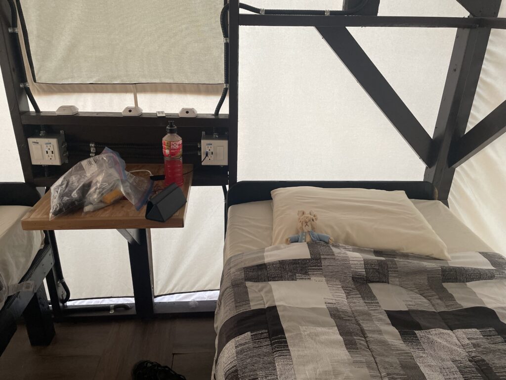
And on to our run down the Alaska Highway, next stop the Yukon Motorcycle Campground, just outside Whitehorse. The campground is a neat idea: exclusive motorcycle-only enclave (it’s part of a larger camping complex with RV spots as well, but they do functionally isolate the motorcycle section), with available “cabin tents” (canvas sided, but more cabin than tent) and showers, but the whole was somehow less than the sum of the parts. Our biases are that we like camping (at least when it’s dry) and we dislike spending money. We paid about $100 for a cabin tent, it was fine, but was not cabin enough for the price. By comparison, Yukon Territory campsites cost about $20/night and include free firewood. But compared to a hotel room it’s decently cheap.
This was also a day we used the proximity of Whitehorse to remedy a few problems. Motorcycle shops close surprisingly early there, but the one that stayed open until 4 pm was good for us, and I acquired some bolts to reattach my loose chain guard, and some more oil: thanks to my botched replacement of a gasket to correct an oil leak, I now had a slightly worse oil leak, which I chose to solve by adding oil. After a slightly distressing rise in consumption in this part of the trip, it settled down and I think I averaged about a litre/week of consumption on the whole trip, not terrible, not great. I also acquired a mattress pad, as I expected, as the trees went away, to be forced to use my hammock tent as a ground tent.
Meanwhile, Tobin used the time to remedy a loose kickstand bolt, which, for Italian reasons, required the removal of a fair bit of the exhaust header, and the purchase of a deadblow hammer, but was otherwise uneventful. (The deadblow hammer was something of a white elephant: too valuable to throw away, but too heavy to casually add to our luggage; being middle class kids we did the latter and it was fine in the end).
Defying our expectations, cel service was far better in the southern parts of the Yukon than it was in the northern parts of BC. It wasn’t until we got to the Dempster proper that we were consistently out of cel service, and once we got to Inuvik, service was normal again. Our rule of thumb was most of the Territorial campsites had cel signal, most of the Provincial campsites did not.
THE GRAVEL
The next day we set out for a signature moment, our first day on the gravel. The route was Whitehorse to Tombstone Territorial Campground, about 67 km up the Dempster Highway.
We set out on what wasn’t too long a day, under 600 km, with a brief pause so I could go to church in Carmacks, the first time I have seen a fully uniformed RCMP officer serve as a lector (and then have to duck out of Mass early due to a call). We ate in Carmacks as well, at the Gold Panner, which was charming and filling.
I believe it was in this stretch that we encountered the mother of all construction zones. It was kilometers long muddy, and led by a pilot truck. At one point, I got very sideways, then very sideways the other way, until I resolved to stop steering the bike so much, which settled it down again, crash averted, which Tobin appreciated as he was worried I’d go under his wheels. This was the closest I came to putting the bike on the ground in the whole trip.
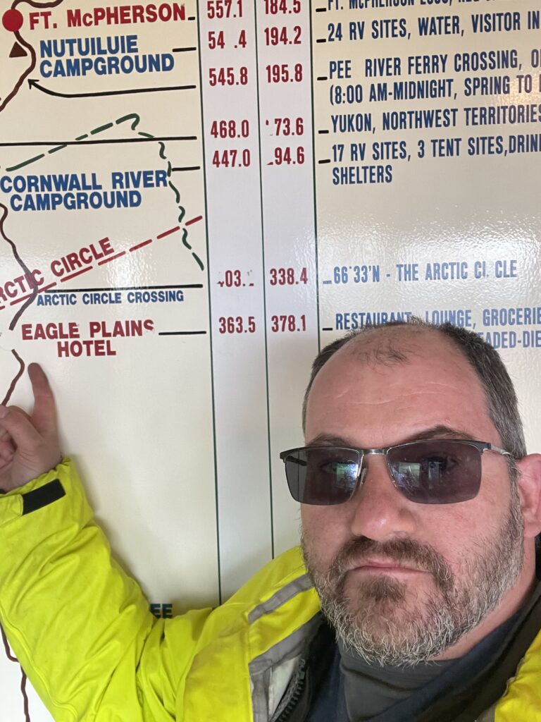
Our next notable stop was the junction of the Alaska Highway and the Dempster, about 40 km East of Dawson City. This was a fuel stop, but with no other services. I mean it: it was two publicly available cardlock gas stations across the road from each other, a portajohn, and that was that.
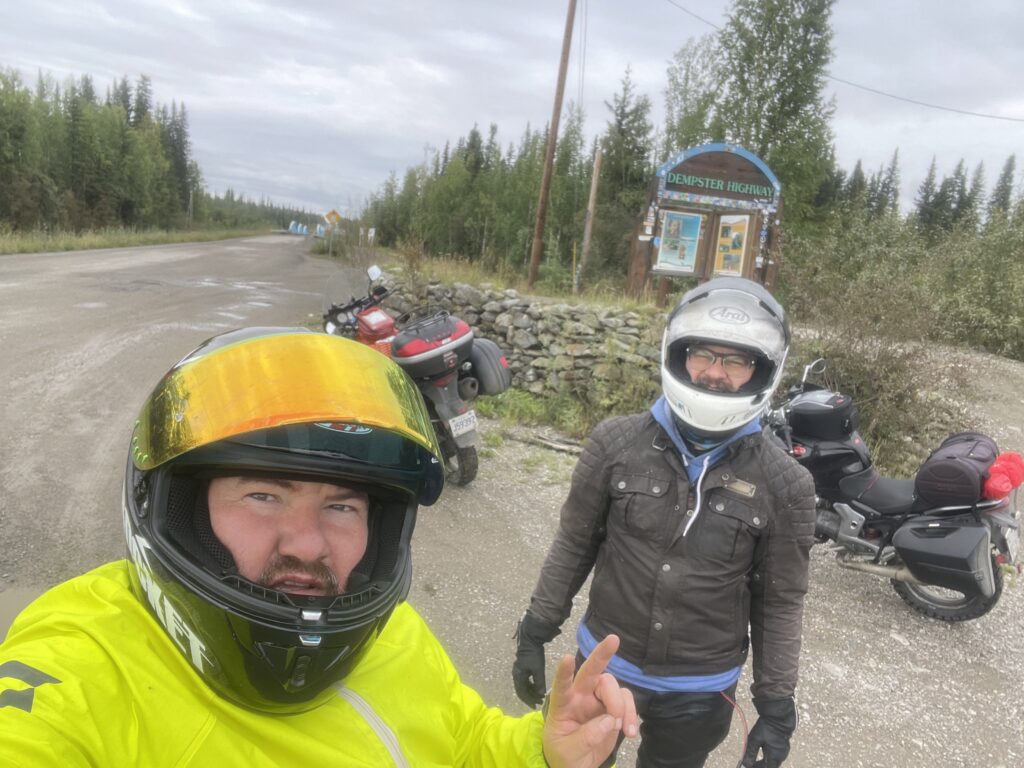
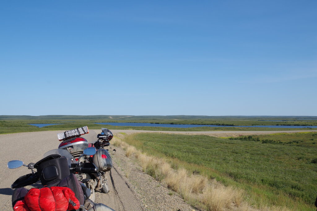
Here we also filled up our non-secret weapon, a 5 gallon fuel bladder. This huge beast was needed because my VStrom has a range of about 350 km running on fumes and hope, and the next fuel stop, Eagle Plains, was 370 km ahead of us. (Moreover, Eagle Plains has a reputation for being a USUALLY reliable source of gas, and if not, its about 180 km more to the next available gas) So with one bladder full and two bladders emptied, we took pictures, then rode on.
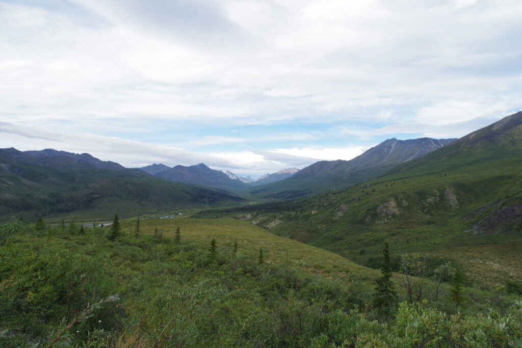
The short run to Tombstone Territorial Park was a gentle introduction to our adventure, and was also the easiest part of our trip. The terrain ranged from mild gravel to hardpack dirt, with as much traction as pavement.
We arrived at Tombstone not knowing what the water situation was, but we begged some water from the staff at the nearby interpretive center, who generously allowed us to fill our containers from their sink, even though the building was closed for the day.
As it happened, there was water in the site, though it was under a boiled-water advisory. The rule of thumb for Yukon campsites was dubious water availability, but a generous free-wood policy.
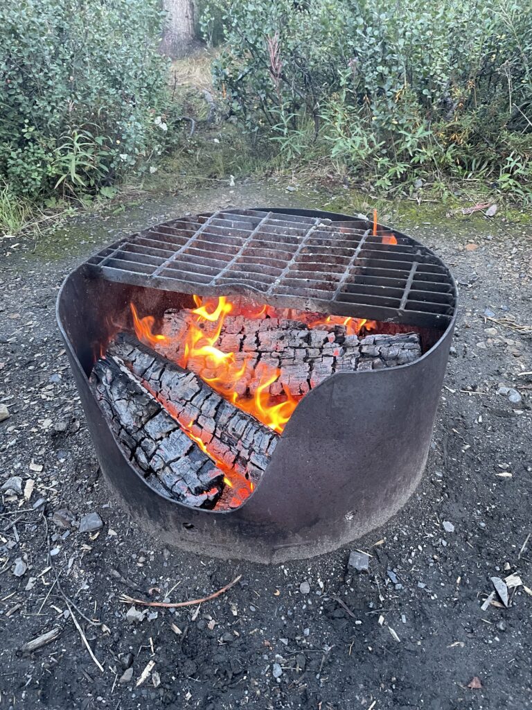
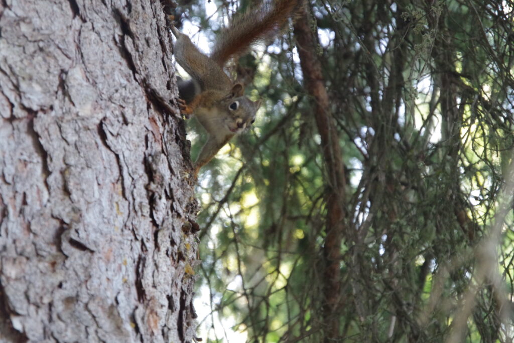
Arriving at the campsite proper, we enjoyed the still-longer days, and faced with a mass of damp but free firewood, came up with the idea of using one of our camp candles to light the wood. This worked like a charm and we managed to make a roaring blaze out of our moist log supply. We were also entertained by cheeky mini-fauna, including a squirrel and a wheateater.
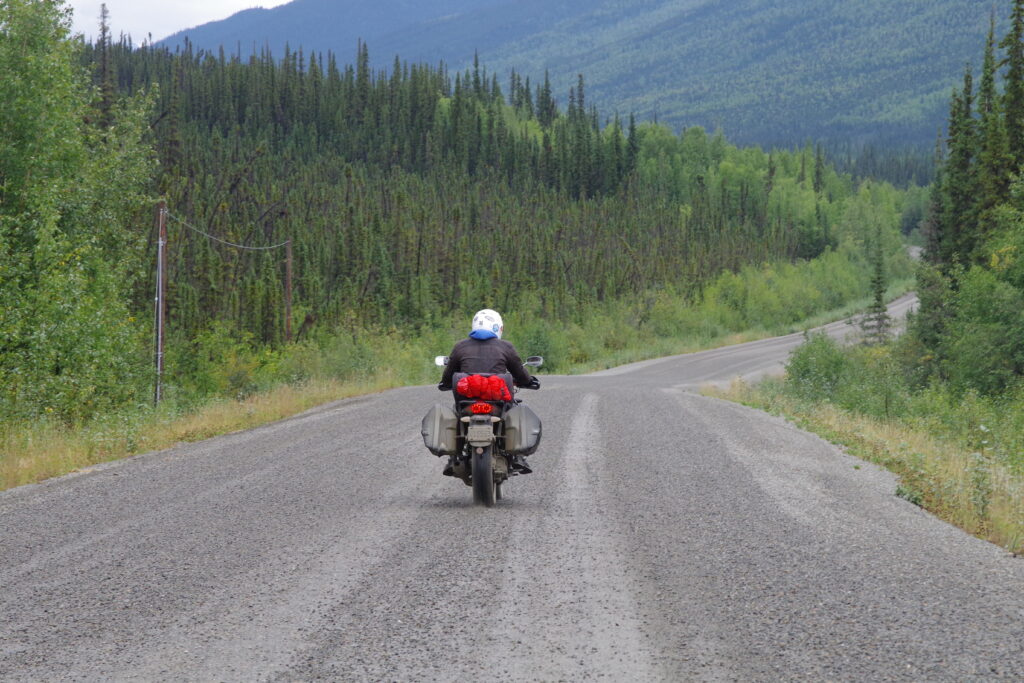
Rising happily, we ate in camp and faced another relatively short day, less than 350 km, but all gravel. It was challenging going in places as the gravel got looser more often, the potholes got gnarlier, and the winds rose. It was not a long day, but it was a challenging day. It paused for a mid-ride top-up with the fuel bladder, and ended at Eagle Plains, where we had a room booked to give us a break.

Eagle Plains is an oasis on the Dempster. Cheekily proclaiming “population 9”, it’s a hotel with a restaurant and another public card lock for a gas station. We refueled after defeating the credit card interface in single combat, retired to the dining room for some food that was delicious, and not only because it was all there was for 100 miles in any direction. We then retired to the delightfully kitschy bar, drank the best beer within a hundred miles, and about this time Tobin declared he was tired of my “hundred miles” line.
AN ASIDE ABOUT WIFI
Say what you want about America’s Favorite Supervillain, Elon Musk, but he turned SpaceX into an ISP that happens to launch rockets. And that ISP, Starlink, has absolutely revolutionized internet access in rural Canada, which was almost all the places we were for the majority of our trip. Eagle Plains was one of several places where we got Wifi service via Starlink, and while we had some access point glitches, when it worked it was very fast, low-latency service. It was as good as any Wifi you’d find on a well-connected urban network.
THE DEMPSTER GETS HARDER
It was about this time Tobin confided in me the secret of loose terrain: just stand up.
Now, I can hear legions of dirt and ADV riders laughing, nay howling, at my naïveté here, but yeah, I didn’t know this.
My fellow doctors, standing up is MAGIC. It immediately settles the bike and makes managing a bike on loose terrain so much easier. I used this trick continuously over the next few days, to the point of fatiguing my legs.
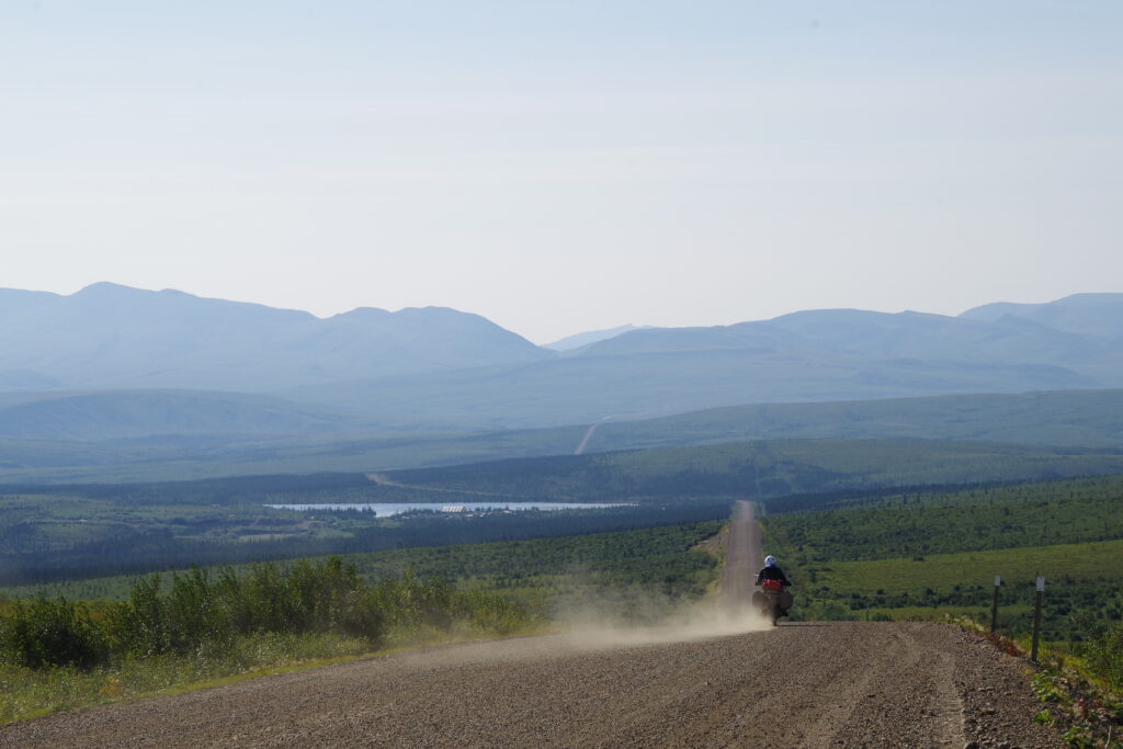
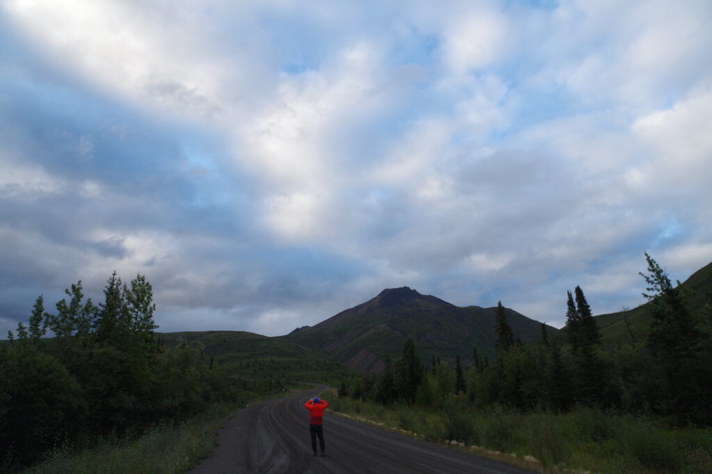
It was good I learned this, because the Dempster got progressively harder. We went from hardpack to some gravel to very loose, deep gravel, and then the winds picked up. Dealing with high winds on the motorcycle while riding on loose gravel was a serious challenge for me, one that felt like it was going to blow me off the motorcycle. But through the power of standing up and keeping my head up, we prevailed all the way to Inuvik.
This is also around the time on our journey that my motorcycle shed its second non-critical part, a bar end weight. Tobin was very glad to be ahead and not behind me when he heard about it.
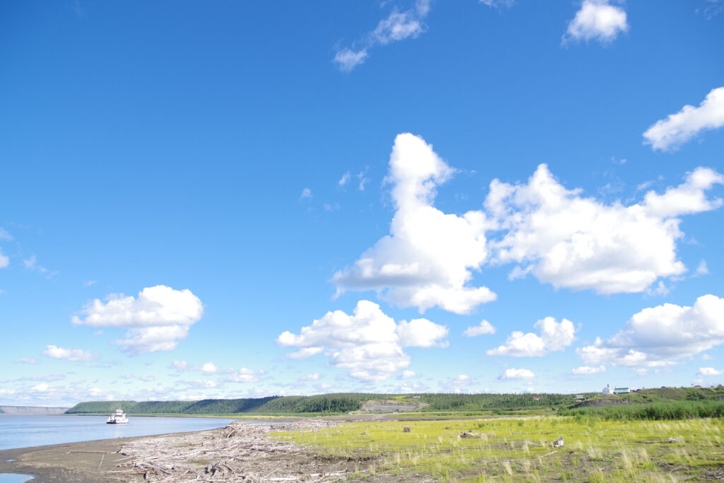
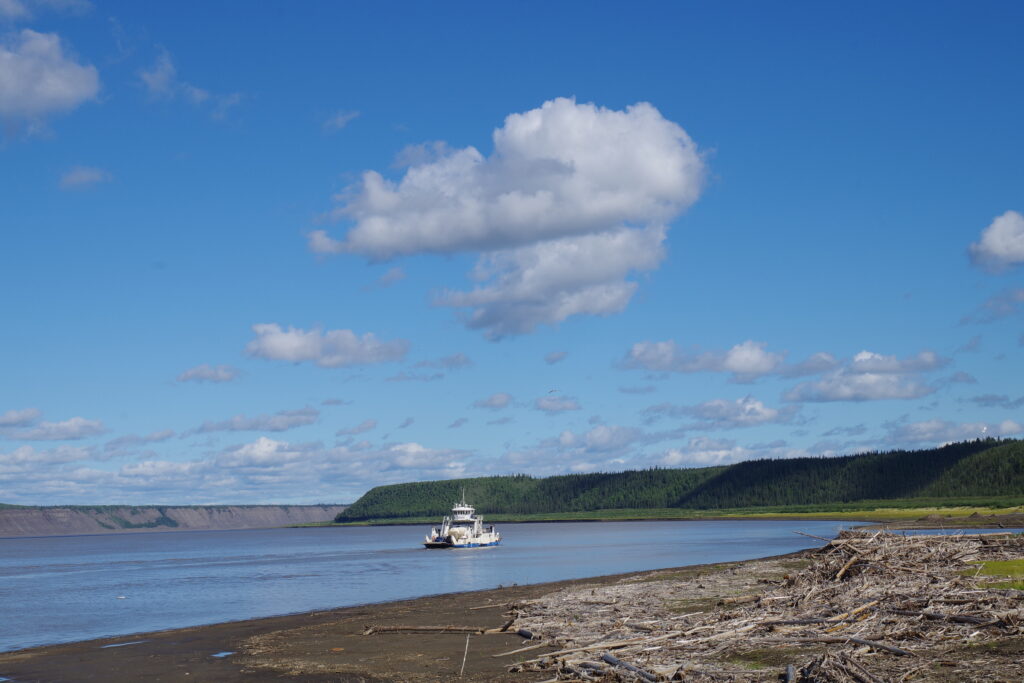
Along the way we made the two ferry crossings, which were mercifully both operational, as we had heard stories about a multi-day outage earlier in the season, and people paying real money to have small boat operators take their motorcycles across one at a time. We managed to experience a one-sailing wait by listening to a well-meaning but incorrect truck driver in the line, instead of doing what all good motorcyclists do for ferries: jump to the front of the line and wait to be told something other than “board first” by the crew.

Just like that we were in the Northwest Territories, and in Inuvik. We stayed in the Jak Territorial campground just outside of town. There’s also a site (Happy Valley) right in town, and it apparently has laundry but is otherwise way less pleasant. Jak has hot showers and real toilets and theoretically wood for sale, but we were never able to quite buy wood. In fact, in two days of staying at Jak, we were never quite able to pay for our campsite, and not for lack of trying: we visited the site office more than once, called the posted phone number and left a voicemail, waved to multiple ranger vehicles driving by our site, and in one memorable case visited the office and talked to an actual staffer, who avowed it would be easier to come in and pay all at once the next day (it was not: the office was closed when we set up camp the next day).
So yes, we highly recommend Jak and hope that unlike us you find a way to pay for camping and wood. The shower was really good though.
ON TO TUK
Tuktoyaktuk is a mere 133 km up the road, so while staying in the town might be nice, it would also be nice to do it as a 266 km round trip.
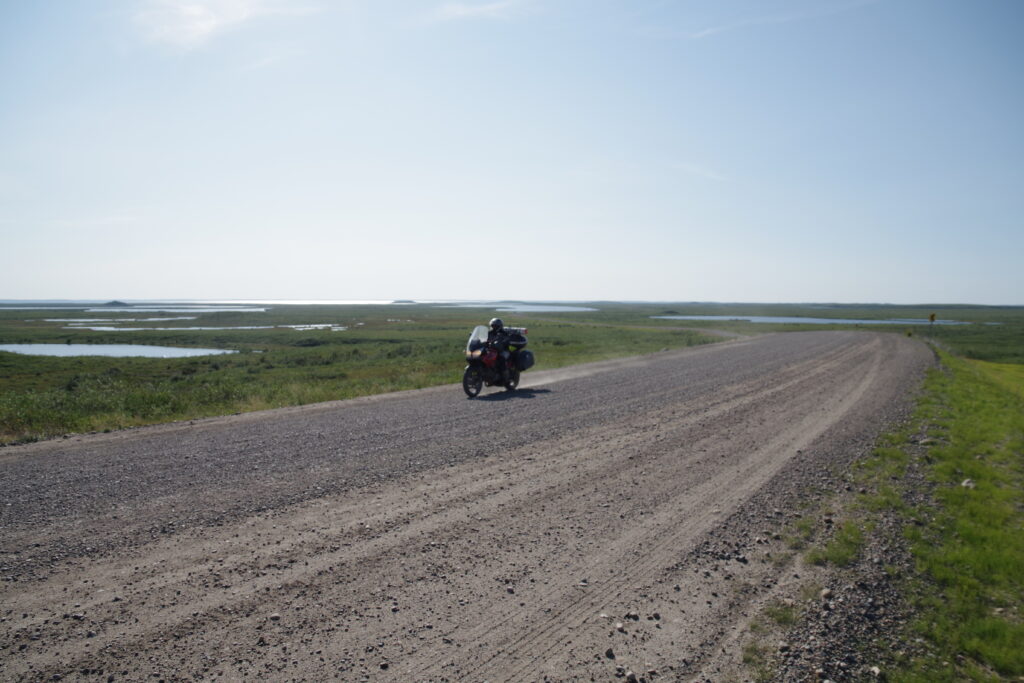
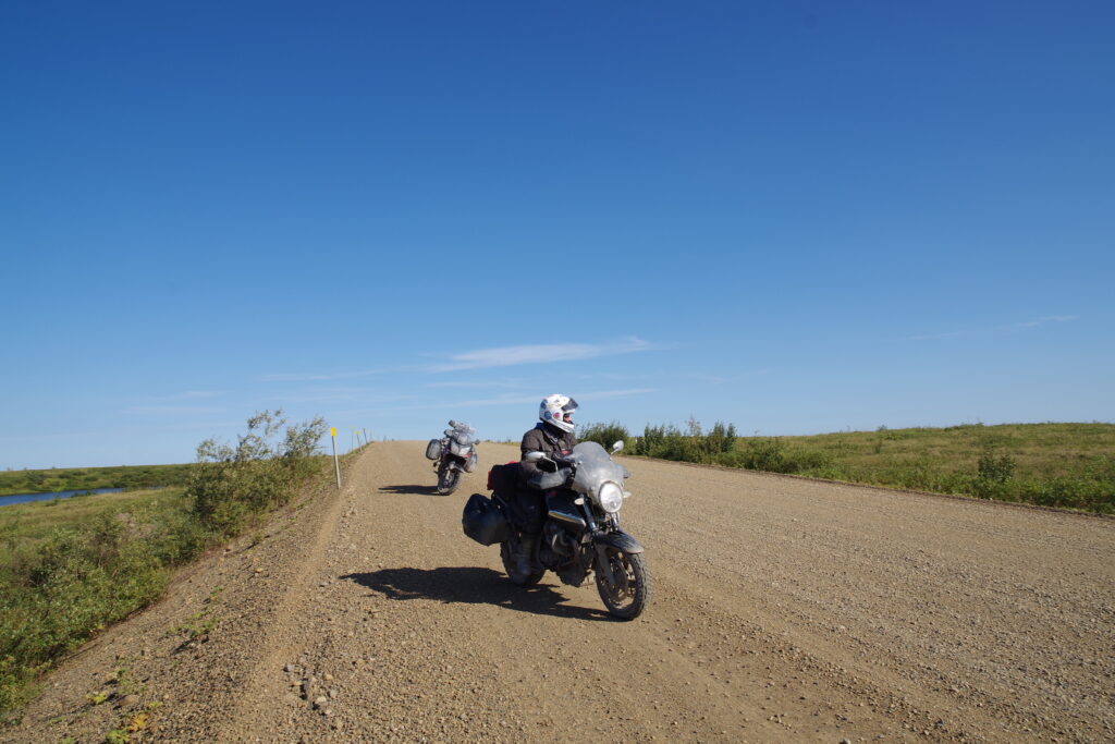
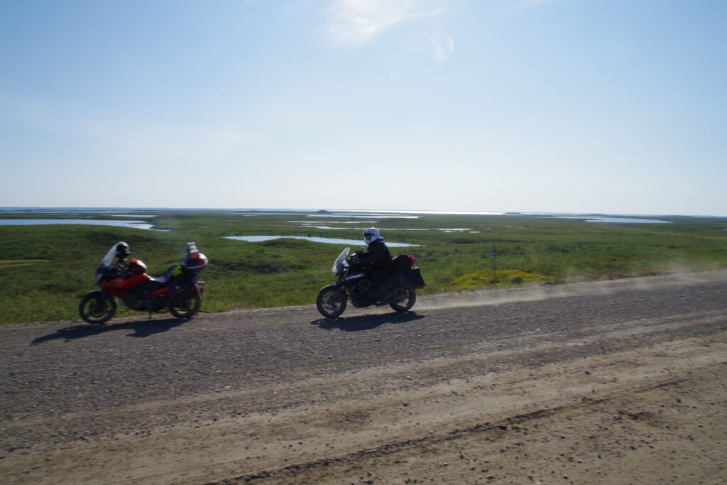
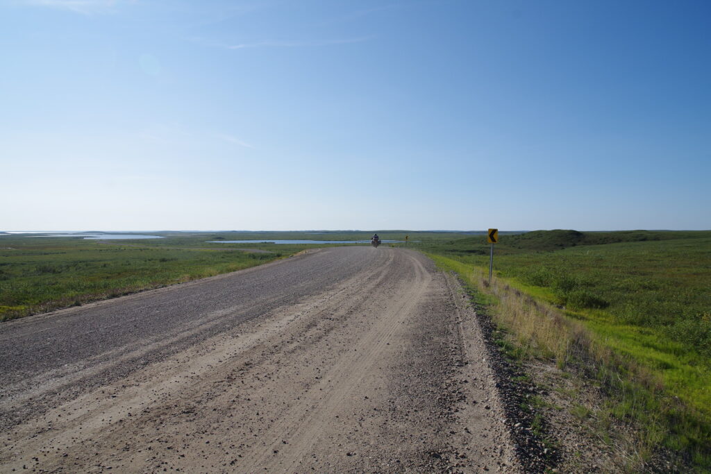
The road to Tuk is noticeably different from the Dempster Highway. It’s newer, and while just as wide, the surface is very loose gravel throughout its length. It’s also gorgeous terrain, as the road winds between little lakes in the extended river delta (or whatever it is) of the mouth of the Mackenzie River. Shortly after you leave Inuvik the trees disappear altogether, we are finally above the tree line (and that’s another reason I wasn’t keen to stay in Tuk).
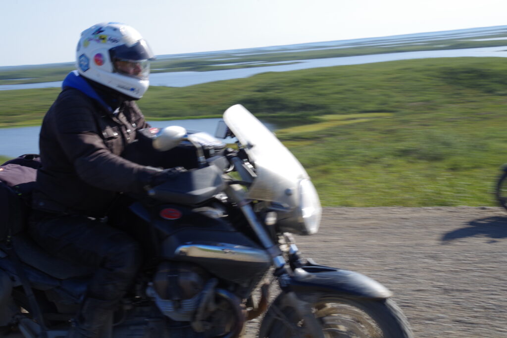
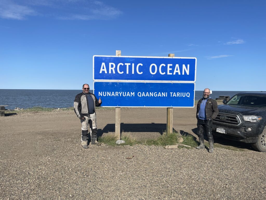
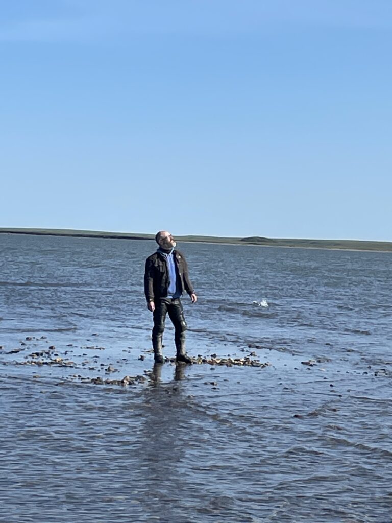
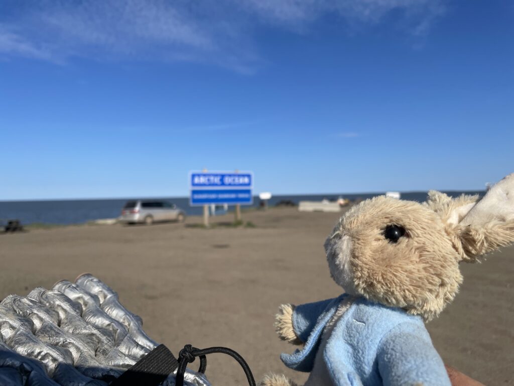
Anyway with some brief stops to regroup and take action photos, including of other motorcyclists who happened to ride by at the right time, we made it to Tuk in a few hours. There we did what everyone does: took photos by the Arctic Ocean sign, and waded into the Arctic Ocean. Like the Scott Expedition, we had reached our goal; like the Scott Expedition, others had beat us there; unlike the Scott Expedition, we liked our chances of returning home alive.
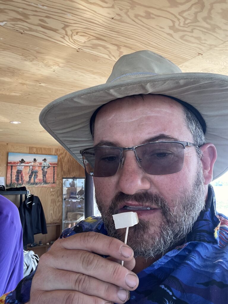
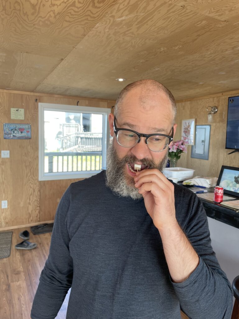
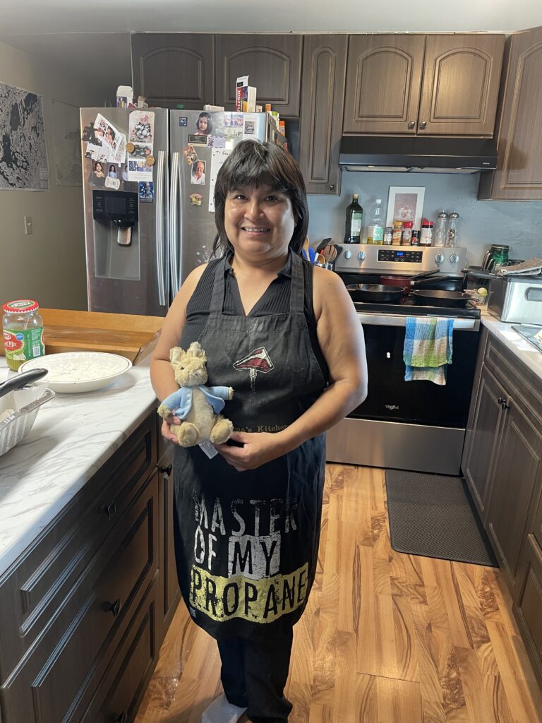
Next, we ate at Grandma’s Kitchen, famous as the only dining place in Tuk that is consistently open. Even in mid-August you are out of the peak season, and so she was serving a limited (and pricey at $40/plate) menu of whitefish and fries, but it was delicious and came with an introductory course of muktuk, aka beluga whale blubber, which was surprisingly delicious. The dining room itself is a purpose-built shack, really more of a freestanding enclosed deck, right at water’s edge and behind the house where Grandma cooks and lives. The experience of talking with our fellow travelers in the dining room and the man who served us (who I believe to be Grandpa) was exquisite.
Don’t forget to pick up an “I ate at Grandma’s kitchen, Tuktoyaktuk NT” sticker for your top box, it’s the must-have accessory for showing up other adventure riders.
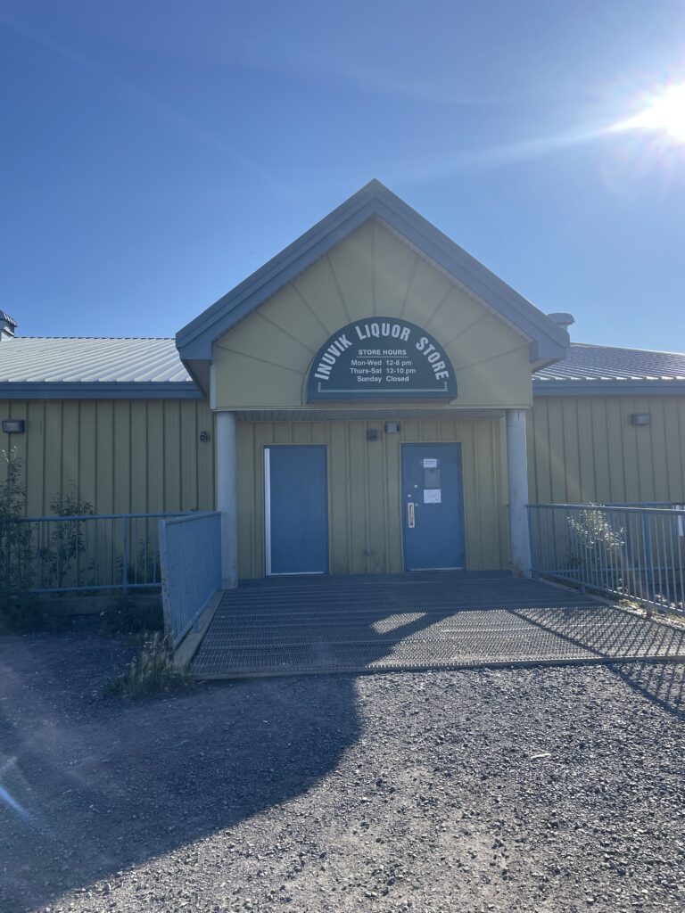
Full and happy, we fueled up and returned to Inuvik for a second night at Jak campground. We also experienced the joys of Northwest Territory liquor laws: the only liquor store in town was government-run and somehow FAR grimmer than a typical BC Liquor store, though the staff were cheerful and very helpful to me. NT also has no off-sales at restaurants, believe me I tried. Are these rules rational policies in a territory beset by the ravages of alcohol abuse? Possibly yes. Do they frustrate me, a person with a manageable alcohol habit just looking to buy some booze? Definitely yes.
We celebrated at the nicest restaurant in town, which is in the lobby of the nice hotel and featured the ambiance of an Earl’s (derogatory) and a purported vegetarian option which, it turned out, was going to be expensive vegetables on a skewer with no hints of protein, but we had to query the waitress quite pointedly to confirm that. Tobin had the vegetarian burger instead, which was available and acceptable, and I had a normal burger, because I am a normal guy.
We retired to camp, toasted our success with a half-bottle of Glenfiddich 12 (the territorial liquor store wasn’t ALL bad), and went to sleep, kinda, keeping in mind official sunset was at midnight, and it was more or less daylight until past 1:30 am. Summers in the Territories!
REVERSE INSTRUCTIONS TO RETURN
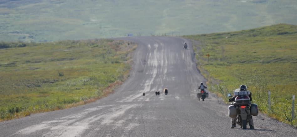
In the reverse direction, the Dempster highway, if conditions are good, gets progressively easier as you go. I was detained by a grumpy mama grizzly with three cubs who decided the road itself, the only strip of human habitation among thousands of square kilometers of wild terrain, was a great place to walk. As I, on a motorcycle, was very edible, I waited cautiously for about fifteen minutes as she ambled along, but a couple of more enclosed motor vehicles got by with suitable caution. After the second one, mama decided to maybe get off the road, and I rode on without getting mauled.
We also endured a couple of road work zones on the Dempster. They are obviously working on this road continuously, which made me wonder about the balance of costs for paving versus maintaining the gravel road, and also at the fact that, for motorcycles, the most treacherous spots were the ones being actively maintained (typically by grading dirt into the road surface, so the top layer is deep mud while they do this work; I’m sure it’s a sound civil engineering procedure that only feels like a deathtrap).
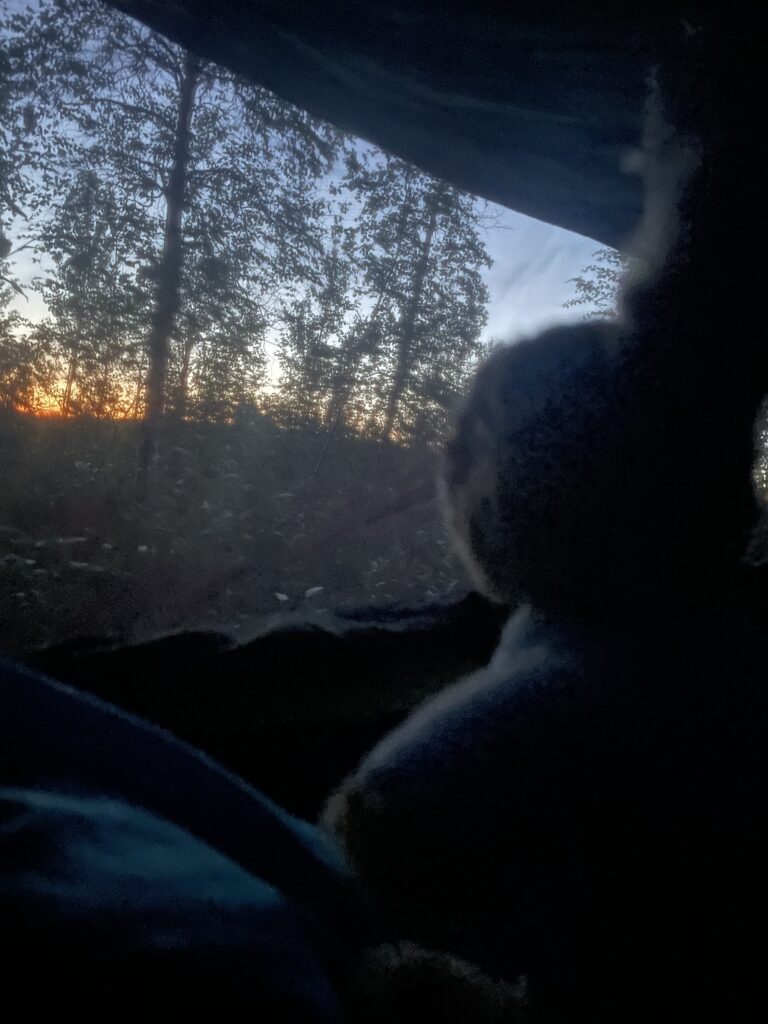
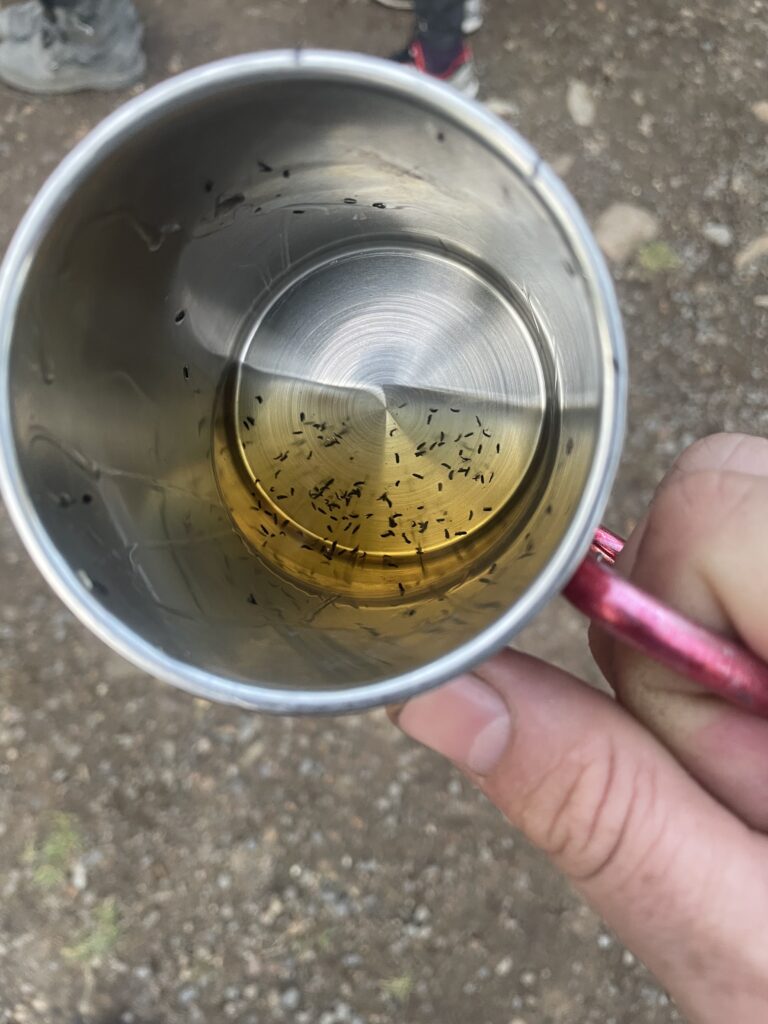
Feeling the call of home, the joy of warm weather camping, and the benefit of ridiculous amounts of daylight hours, we stopped at Eagle Plains only for gas and dinner, then pressed another 175 km down the road to Engineer Creek Territorial Park, only to find…it was full. So we pressed on slightly further, and camped in a turnout beside the road. We had snacks, a camp candle, and the highest mosquito count of the trip (plenty, but not the “hid the sun from view” numbers of legend).
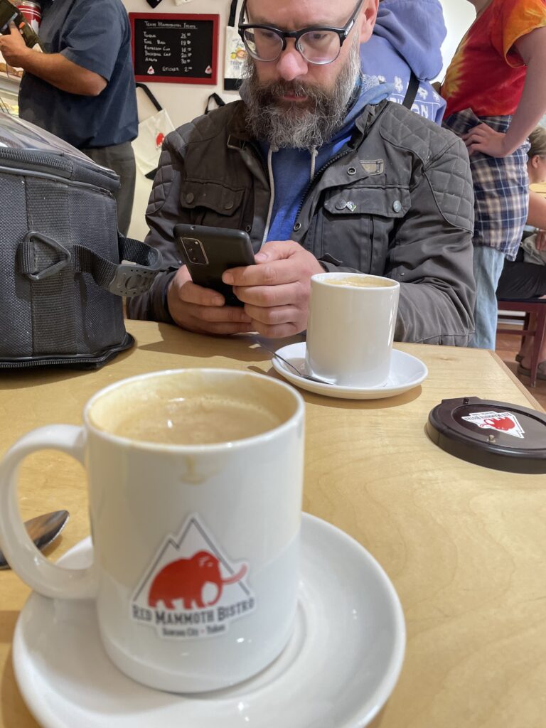
That was a long day, but it meant a short jaunt into Dawson City for a sort of rest day. We knocked off the rest of the gravel and the 40 km detour to Dawson City in time to have brunch at the Red Mammoth Cafe (worth it). We set up camp at Yukon River campground, a short ferry ride across the river from Dawson City. Pro tip for Dawson City: the campground doesn’t have water, but there’s a free water fill site in town. Use the city’s website to look for the automated water fill station. There’s a bunch of verbiage about setting up an account for bulk filling water tanks but if you ignore that and go to the site, you’ll see there’s also a red button for filling a water jug for free. The fill rate is hilariously strong, it took about a second to dispense 2 litres of water, worth visiting just for the entertainment value.
Dawson City is adorable and only moderately into itself, though to be fair we arrived on the eve of Discovery Day, which is basically Dawson City Day, complete with a parade (which we sadly had to skip) and lots of visitors. Anyway, Dawson City is more Gold Rush Disneyland than Real Town at this point, but it’s done well enough that I plan to return to do all the things I missed this time.
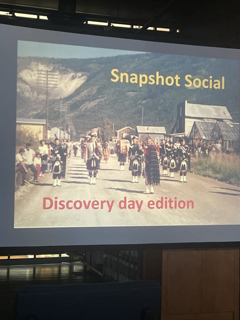
We ducked into the Dawson City Museum to check things out, and because it was near closing time they declined to charge us admission. Then we found out there was an open event happening right at closing time, a slide show from the city archives.
So it turns out community events like this are EXCEEDINGLY well-catered in Dawson City, so without making utter pigs of ourselves we indulged in a spread that included double-baked potatoes, rich cheese pies of some type, deviled eggs, an open bar (with the gentle suggestion that having more than one drink might be ahem, by donation), and a slice of chocolate torte that was darker than my heart and richer than Jeff Bezos.
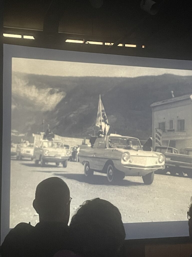
So that was dinner, and the show was also lovely: 2 hours of slides mostly themed around the Discovery Day parades of yore, where it would be a shot of majorettes in the 60s and one of the majorettes would be in the audience and point herself out, or there was a mystery building in a photo and the lady who bought it from the city, also in the audience, would tell the story, or that time a fleet of Amphicars floated down the river from Whitehorse to Dawson City!
We rolled back to our campsite sated and entertained, a worthy celebration of getting back from the Dempster Highway. Remember kids: always crash the party.
From there it was back to Whitehorse the next day, but we skipped the motorcycle campground for a Territorial site. We also used the Norgetown laundromat, which is better than its online reviews and has delightful steampunk washing machines and a staffer who happily engaged in a duel of laundry puns, and defeated me.
The next day we rode back to Boya Lake. We didn’t have a reservation, but the kind park ranger directed us to a sort of overflow/day-use/bicyclist camping area right beside the lake. We inveigled ourselves into the spot of a fellow motorcyclist, and bought two more tubs of wood from the same ranger as on our last visit, and she said the same thing: “are you sure? That’s a lot of wood….”
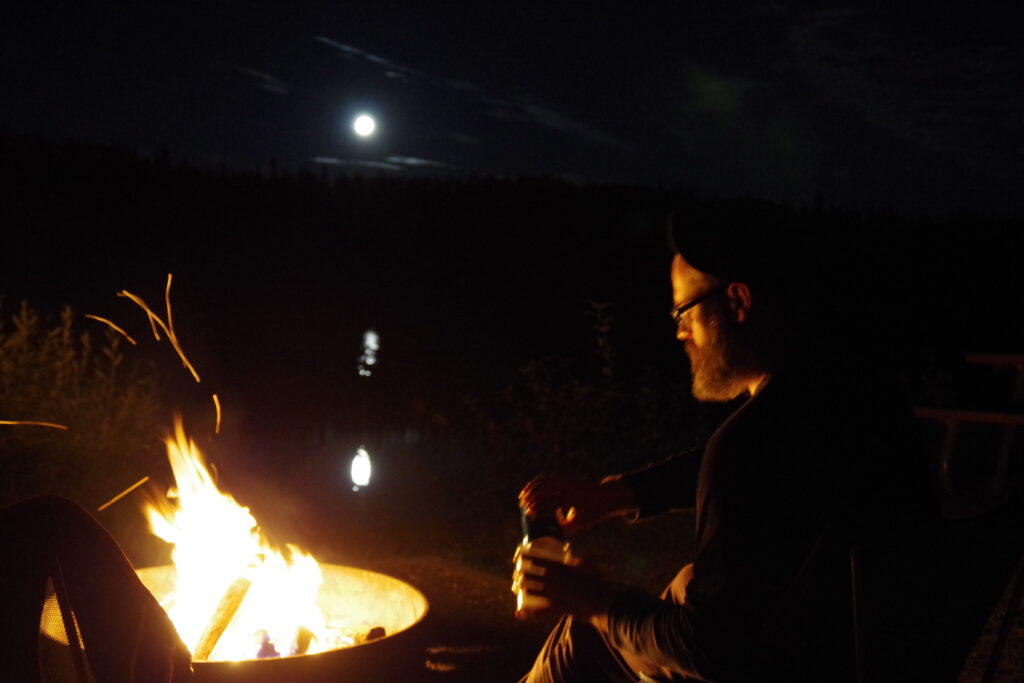
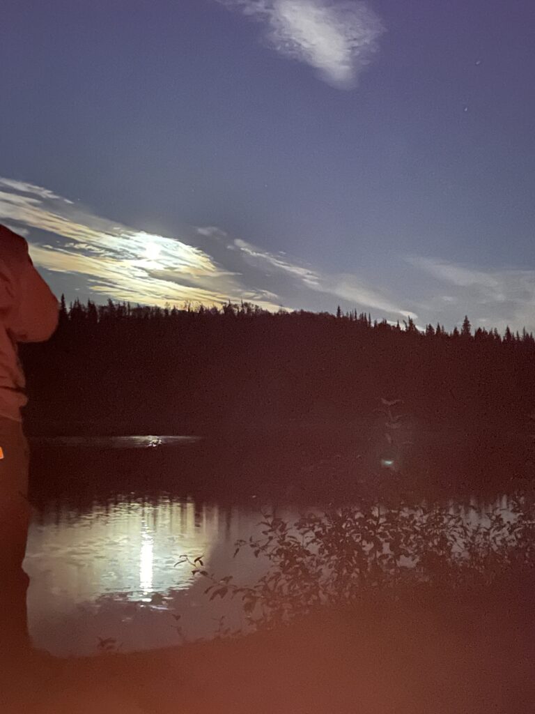
Then we had the best camping experience of my life. There was only one fire pit serving four overflow spots, so as we got the fire going I went over and invited our near neighbors to join us at the fire. We had a lovely communal experience involving a pair of Germans on their way back from cycling to Tuk, our motorcycle friend, also a German, who was riding his 90s Springer Softail to Alaska, where he would leave it at his daughter’s place before flying home, and an young man from nearby Watson Lake, along with his new girlfriend Gigi from Quebec via Calgary, and her giant dog Loki. We quietly chatted around the roaring fire late into the night, and shared our strange Canadian snacks (Cheezies) and well-tier rye, and the full moon rose over the lake so bright it was absurd and the whole thing could have inspired half an album of sweet, cosy, but strangely melancholy songs by The Tragically Hip.
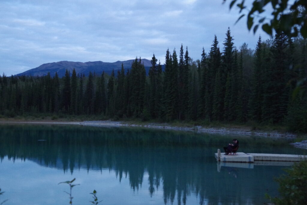
Oh yeah and Boya Lake is also a delight to swim in, 5/7 would fail to have a site reserved and buy too much firewood again.
I’M ON A BOAT
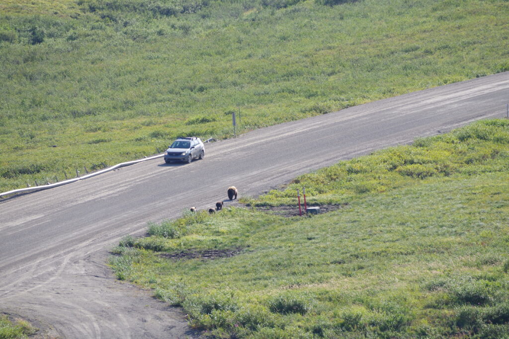
The next night was Meziadin Lake, where we were briefly driven out of our site by roaming grizzly bears, but also where we met two extremely resourceful young men who were obviously good people because they were heavy mechanics and both riding Suzkui V-Strom 650s, the official motorcycle of good people having adventures. But most importantly they were fresh off of sailing the Inside Passage and gave us some real, actionable information about how that rather odd ferry run actually worked, and also, strangely, how to access an actual human being at a particular ferry terminal (the secret is to call the terminal number and use the menu tree to get to “lost luggage” which is the only option that rings an actual phone at an actual desk at the actual Prince Rupert ferry terminal, is this an Infocom text adventure??)
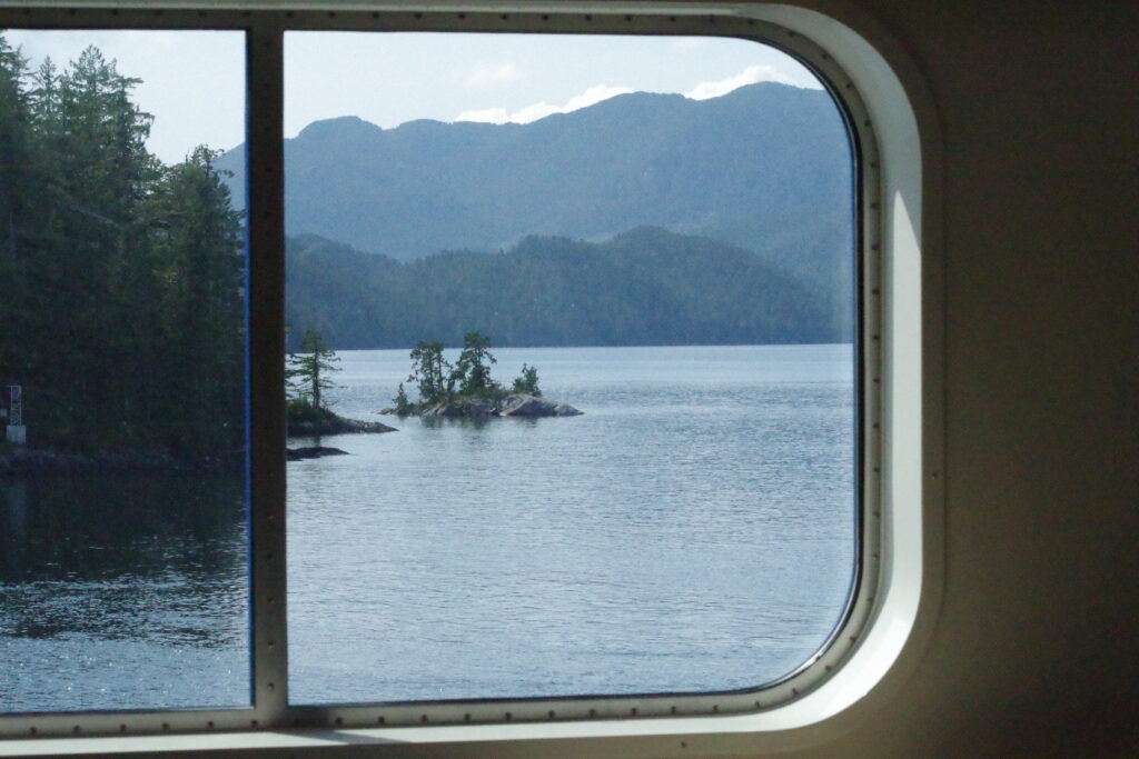
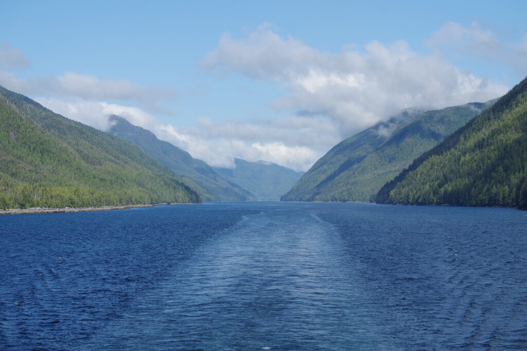
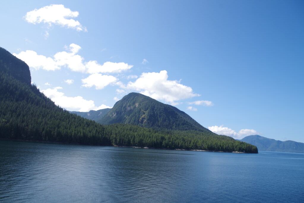
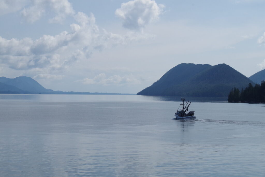
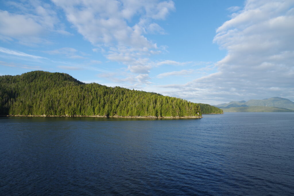
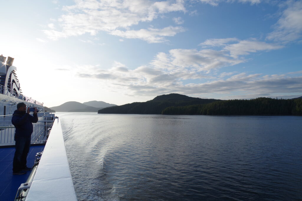
So here’s the deal: the Inside Passage is the run from Prince Rupert on the coast, to Port Hardy at the top of Vancouver Island, or vice versa. It is a 16-hour cruise famous for the scenery and whale-watching. It is also, in theory, a fully reservation-booked run but that is hardly the whole story, but of course the BC Ferries site and most other sources don’t tell you what you really need to know about getting on board.
Maybe peak periods are different, but most reports say the boat travels with plenty of accommodation for people aboard. On our “fully booked” trip there were probably three empty seats for every passenger in the main lounges.
So what actually books the ship up is vehicle reservations, and mainly non-oversized vehicles. Reservations are booked based on 20’ of deck length per car for cars under 20’, plus allowances for vehicles reserving and boarding at the intermediate stops. Because of this, there’s almost always plenty of room for extra motorcycles, and I was straight out told by a ferry worker over the phone that “we almost never leave motorcycles at the dock.”
Anyway that’s a long-winded way of saying that we didn’t want to divert all the way to Prince Rupert without being very sure we were going to get on the ferry, and this gave us the confidence we needed to head to the coast.
The route there bears mention: Tobin found a side quest in the form of Route 113, aka the Nisga’a Highway. According to some accounts it was fully paved, but according to other, more accurate accounts, it was 50 km of forest service road followed by a winding ribbon of fresh pavement. Both parts were enjoyable, but the pavement wound through an amazing landscape of lava fields that was completely surreal, unlike anything else we saw on our trip, and for some reason I never stopped to take a photo.
So we camped near Prince Rupert, and showed up as instructed in the ferry line for when the gates opened at 5:30 AM (sailing time 7:30), and indeed we got on board.
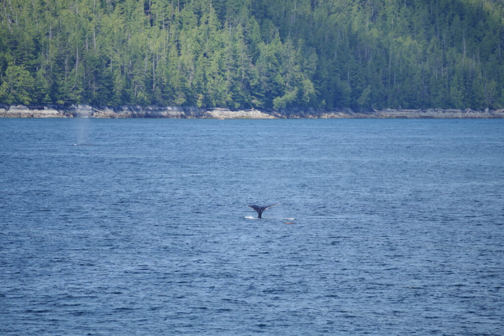
This was a great choice. Aside from the joyful scenery, the ferry moved us well towards our home and gave us a much-needed full rest day off the bike, albeit at the cost of a 4 am wake-up call in our campsite and a midnight departure from the ferry in Port Hardy.
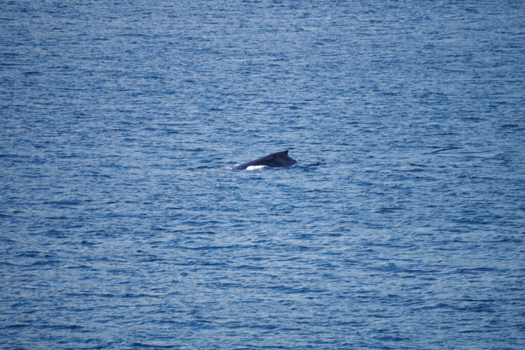
The experience aboard the Inside Passage has been described as “like a cruise ship” but only by people who have never been aboard a cruise ship. It is elevated above the standard Vancouver-Victoria routes by comfier chairs, a movie theater (we did not indulge, but the 4-show bill included “The Goonies” and “Top Gun: Maverick”), and a bridge crew that dutifully announces whale sightings just in time for you to rush outside and maybe see a blow of spray before the whales dive for another ten minutes. We didn’t buy the $40 premium lounge upgrade, which has slightly comfier chairs. The fancy buffet is perma-closed, and the Coastal Cafe on board is recognizably a BC Ferries cafeteria, with all your favorite offerings and a tendency to sell out of things.
Anyway, it’s perhaps a one-and-done thing, but despite the considerable costs, I think the cruise is worth doing once, and we enjoyed it.
Plan A for our exit in Port Hardy was to reserve accommodations in town, since it would be midnight when we got off, then take a leisurely cruise down to Nanaimo, visit friends, and be home the next day. But when we couldn’t get a room a new option opened up: ride through the night, get on the first ferry out of Nanaimo, be home in time for brunch.
After two weeks on the road, we were hungry for the comforts of home, so that’s what we did. The Island highway is not four lanes all the way to Port Hardy, but it is for at least half the route. There was a 5:15 sailing from Duke Point to Tsawassen.
Between a late arrival in Port Hardy and my slow pace on the dark highway, we made it to the terminal just before 5 am, and just in time for boarding. Tobin and I bid adieu to each other just before we rolled off the ferry, and an hour later we were both home in bed.
FINAL THOUGHTS
More than a lot of places, the journey is the destination here. I think I would take more time to take in the sights if I had more time, and while I’m glad we went to Tuk for the experience and for every other reason, it doesn’t call out for a repeat trip. The Dempster Highway is just a road, although it is quite a lot of road, and riding it once was a thrill.
However, I will make return trips to the following places:
- Dawson City, gotta drink the sour toe cocktail
- Boya Lake, the prettiest place I’ve ever camped
- Route 113, I need some photos
- Ben’s house in Smithers, gotta beat him at pinball next time
- Ten Mile Lake, I’m just putting this in because we’ve stayed at Ten Mile Lake multiple times and it’s somehow unmemorable, but also an excellent waypoint to visit the middle of BC and beyond, so we’ll surely be back.
In the end, the real joy of a motorcycle camping trip is the chance to see a lot of sights, travel fairly light, camp, and of course ride motorcycles lots. Motorcycle camping is something I will absolutely do again and again, as often as the opportunity comes up, and more generally, light off-roading is now very much on the menu for future trips.